strategic Planning
Our Strategy
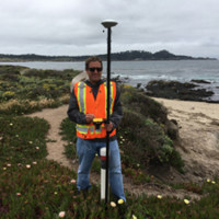
Conduct a GPS Field Audit
Using your current GIS our team updates the attributes and locations using high-resolution GPS.
Green Infrastructure Design
Using the updated GIS and field notes our team highlights projects in your service area that would benefit from Green Infrastructure.
Maintanace Follow Up
Once installed, GI projects are added to a work order Web GIS that helps keep track and maintenance your GI Projects.
Geographic Information Systems
GIS Powered by TiGEO ®
Our Company
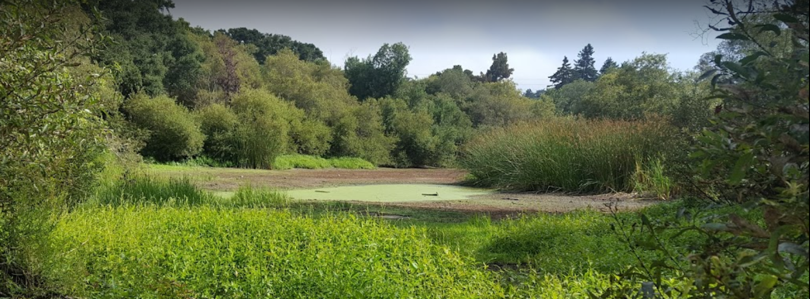
The vision of Green Infrastructure Design (GID) is to enhance ecosystem services by converting old infrastructure into new resilient green infrastructure. With the continual rise in climate change, droughts, and mega wildfires it is important to design with nature in mind. We call these areas of opportunity Nature Ground.
Nature Ground is the little areas between our daily lives that could be improved to provide more ecosystem services to ourselves, our community, and our natural environment. Small little projects are just as important as large projects. We look at nature in an urban landscape as islands of natural habitat. Your yard may be a small project, your next-door neighbor’s yard may be a small project, but together these projects create a more ecofriendly habitat that could reduce water use, minimize pollution, and limit wildfires. Larger projects, such as a new development, a community park renovation, a waterway improvement, or improvements on a public works easement all provide opportunities to improve Nature Ground. Improving your home or business could be funded under new grants and rebates.
#GreenTeam
Meet our talented, skilled and friendly team! Together we do one major and important job – empower your staff on GI and GIS.


GIS Project Development Since 2002
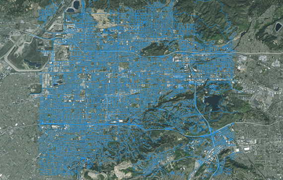
Water System Mapping
We have mapped well over 60,000 water assets using high-resolution GPS to update and covert GIS systems. Using a GPS Field Audit, Our Green Team will improve the accuracy of your systems.
Wastewater Mapping
GPS mapping is only one way to improve your GIS. Attributes of your data are more important than the location. Updating information with as-builts and notes allows your GIS to be displayed with insight.
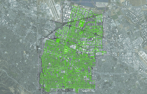
Green Infrastructure Mapping
Our Green Team will locate areas using GIS and GPS that could greatly be improved with Green Design. With Web Maps and Field Apps your team is more informed of where to start being green.
Our Collection numbers
A GPS Field Audit helps to improve your GIS and helps define GI Projects.
Our History
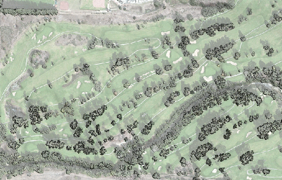
Originally incorporated in California on March 14th, 2002, as a golf course consulting firm, our company pioneered the use of Geographic Information Systems (GIS) and Global Positioning Systems (GPS) for irrigation and course feature mapping. Notably, we contributed to the development and design of the Bayonet Black Horse Golf Course and the GIS mapping of the reclaimed water system for the Pebble Beach Company and the Pebble Beach Community Service District (PBCSD).
Over the years, GID transitioned from turf and irrigation mapping for golf courses to water system mapping for local and statewide purveyors such as American Water and Global Water. Our team’s application development and field asset mapping played a key role in designing the award-winning water conservation program at the Irvine Ranch Water District (IRWD).
We also developed the Carmel Area Wastewater District (CAWD) GIS for maintenance and capacity projects, including the GPS mapping of the golf course water reclamation system at Pebble Beach. Other significant local projects include the initial wastewater conveyance line mapping for the innovative Monterey One Water (M1W) reclaim water project and the as-built mapping of 20,000 acres for the Santa Lucia Preserve Community Service District (SLPCSD).
Our firm created the Natural Resource Management GIS for the Monterey Peninsula Regional Park District (MPRPD), a land-use planning and conservation tool for preserving open space. The Visitor Education Guide (VEG) and MPRPD Explore! are integrated into the MPRPD Let’s Go Outdoors (LGO) mobile app, known as “LGO on the GO!” This app allows historical information to be added to the MPRPD GIS for storytelling and educational purposes at the Visitors Center and throughout the parks.
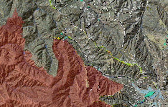
Before the devastating fires of 2020 in California, our team developed many pre-fire plans using Web GIS, including GIS Hubs for the Big Sur Fire (BSF) and Woodside Fire Protection District (WFPD). These hubs are used for Wildland Urban Interface (WUI) inspection, pre-fire planning, and asset management. Additional fire-related projects include the Fire Fuels Mapping Project (FFMP) for California State Parks and the Monterey County Resource Conservation District (MCRCD) in 2019. The RCD FFMP serves as a historical library of information used in strategic fire and fuels planning projects across Monterey County.
Our team designed and produced various online and mobile resources, including the Real Estate Guide, Hiking Trail Map, and the 911 Emergency Map for the Santa Lucia Preserve. We also developed the Big Sur Fire Pre-Attack Maps, Pebble Beach and Carmel Highlands Pre-Attack Maps, and mobile maps for Garland Ranch Regional Park and Palo Corona Regional Park. Our firm not only designs maps but also creates mobile applications for recreational hiking and crisis field directives, featuring QR codes and user-friendly mobile maps for events or nature hikes.
Today, our firm provides Web GIS Mapping, Web GIS Training, High-Resolution Drone Flights, Mobile Application Development, Natural Resource Management (NRM) & Green Infrastructure Design.
Our Core Concepts
It’s Easy 2B Green! Green Infrastructure Design has many services to improve your home, business, and community.
Our clients